")
")
GeoTop serves to perform the quality control, the processing and interpretation of wellbore surveys, the preparation of graphic pads to print, including the set of curve and graphic parameters.
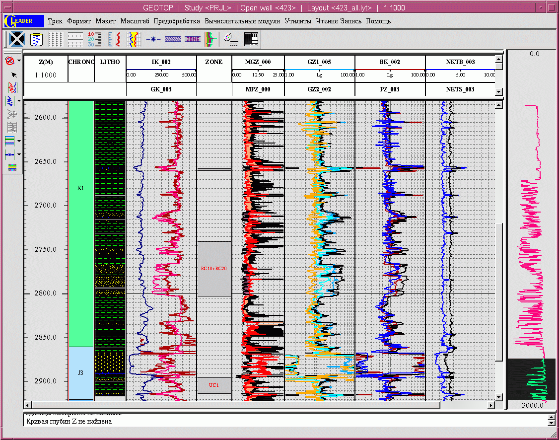 The main purpose of the Software is supplying with the loading of quality logging data and receiving the computed parameters of reservoir beds.
The Software origin starts from 2000. The 1.0 – 2.1.1 versions have been created.
GeoTop is being used in such companies as LUKOIL – West Siberia Ltd., ReMASA, State Company of Khanty-Mansyisk Autonomous Okrug – Yugra "V.I. Shpilman research and analytical centre" as one of the modules of Tigress Software for the quantity control, processing and interpretation of geophysical data.
The Software features are based on the modules' usage, providing with the realization of basic procedures that are applied in quality rating and well log interpretation: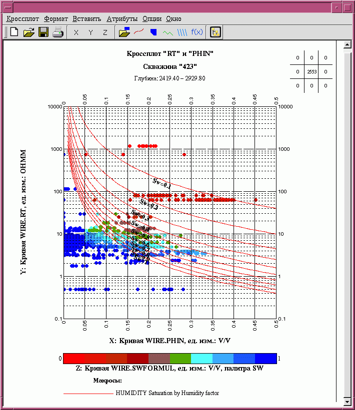
- The usage of graphic interactive analysis with the prestack data visualization and data processing results on a real-time basis during the whole period of quality control and computations.
- The usage of split-screen graphic system where all gates are logically linked. The performance of any action, resulting the information alteration, brings the displaying of altered information in all other gates, contained this information.
- The users' Software connection is realized without developers' input.
- The transport of configurable parameters in the external files to provide with the safety and transport of user's standards and performance periods.
- The usage of varied pitch of curve discredit.
- No limit in the scope of information.
- The usage of core, well fluid and other field-geological information analysis results. The petrophysical equations analysis.
- The interpretation in continuous or interval form.
- The interpretation in interval form within the difference of cross-section parameters and depositional conditions.
- The Software GeoTop executes according to the Server-Client technology and with different data base.
GeoTop advantages compared with the majority of western Software expressed by the deep integration with the storage and control tools of geological and geophysical data on the base of PetroVision, within the Russian geophysical equipment and technologies particularity (there is an opportunity of resisting calculation for the Russian geophysical equipment within all necessary modifications and etc.). The main value of the Software GeoTop is its Russian origin and profitable rate of price-functionality.
The technical requirements are defined by: (a) Server or PC based on Intel Pentium processor (AMD analog) at frequency not lower than 2.5 Ghz RAM – 2 Gbs and 5 Gbs of the disc space; (b) Operation Environment - Rhel 4 and above, Centos 5. (c) Oracle - not lower than 10 version.
The Software GeoTop development and custom programming is suspended now.